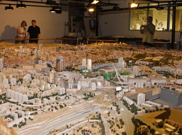
Certainly, others have documented the value and recurring popularity of the scale model as an inspiration for comprehensive thinking about city form, both from the perspective of the seasoned observer or an orientation for the neophyte. From such a one-stop view, the relationships of history land use, transportation and the natural environment can be readily ascertained.
Around the world, such city models are regularly updated as urban landscapes change, a three-dimensional depiction of what American planning and zoning maps can only hope to inspire.
The scale model can clarify the unique footprint of the subject urban area, and visits to and photographs of the model’s venue can educate, advertise and identify challenges, opportunities and solutions.
Need we be limited to the desktop Sim City? Need such real life, physical models await artistic inspiration, world expositions or other landmark occasions?
Philanthropists and grant-makers: In a time of municipal fiscal restraint when such endeavors may not be otherwise achievable, why not fund cities that apply for the privilege of creating the scale model tool?


Pingback: Don Richardson
Pingback: Peter Stoyko
Pingback: The Rainbow Chain